Smart thinking: David Baumann quickly planned a hydraulic structure in the Bernese Oberland using ALLPLAN Civil – because it’s simply the perfect fit. Typical engineer thinking ...
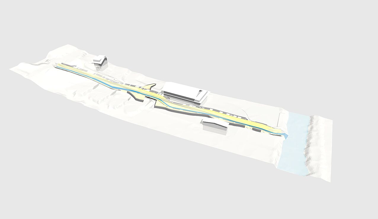
With ongoing climate change, extreme weather events such as heavy rainfall are becoming increasingly frequent. The term “century floods” has become misleading, as they now occur almost annually. In addition to necessary climate protection measures, effective technical flood protection is crucial, especially in mountainous areas where heavy rainfall can quickly become life-threatening if flood protection systems exceed their capacity. That’s why the renewal of a hydraulic structure in the Louweligräbeli area of the Bernese Oberland in Switzerland is currently being planned. The aim is not only to improve flood protection but also to enhance the ecological functions of the stream. The engineering firm David Baumann has taken on this task – using ALLPLAN Civil.

3.3 Cubic Meters Per Second
The structure to be renewed is located on a campsite in the municipality of Lauterbrunnen. Two watercourses merge in this area to form the Louweligräbeli, which flows into the Weisse Lütschine. In the event of flooding, the hydraulic structure must be capable of handling a peak flow of up to 3.3 cubic meters per second (HQ300). However, the deteriorating condition of the existing structure currently limits its effectiveness, so a replacement is needed. Possible solutions include a one-to-one replacement of the concrete shell, a natural profile, or lowering the riverbed. At present, a combination of a replacement structure and a natural profile is the preferred approach.
The project presents several challenges. The limited space between the riverbed and an underpass makes it difficult to implement a natural profile while keeping the underpass intact. Particular attention must also be given to the connection with the Weisse Lütschine, which has a catchment area of 165 square kilometers. If both watercourses flood simultaneously, a dangerous backflow could occur, which must be prevented at all costs.
Planning the Hydraulic Structure with ALLPLAN Civil
Interestingly, David Baumann is using ALLPLAN Civil to plan the project. The reason? Hydraulic structures share many similarities with road construction in terms of their design, making them suitable for parametric modeling with the software. In the end, it’s all about combining the right functions. For example, the engineer uses the main roadway from the cross-section templates as the riverbed, adjusting its width by layering and modifying design elements (superpositions) to fit the given conditions. The side slopes of the watercourse are implemented using additional lanes with extreme cross slopes.
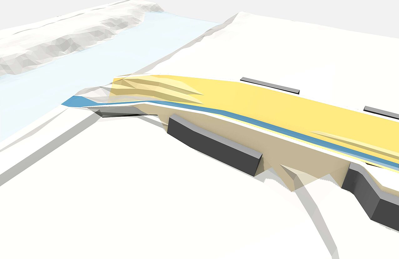
The crown of the structure is formed using the shoulder feature. From here, a roadside template defines the embankments. Using the retaining wall function, David Baumann can automatically determine at what embankment height a retaining wall or a block stone wall is necessary.
This modeling method allows him to generate multiple variations in a very short time. He can then use the models to create and compile plans, calculate quantities, and, most importantly, make an engineer’s ideas more tangible for project stakeholders.