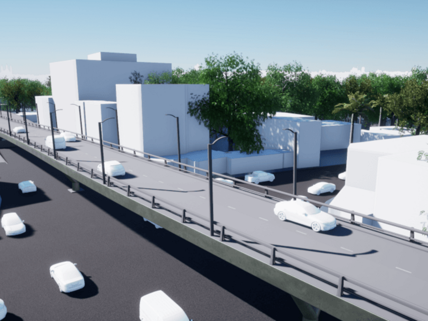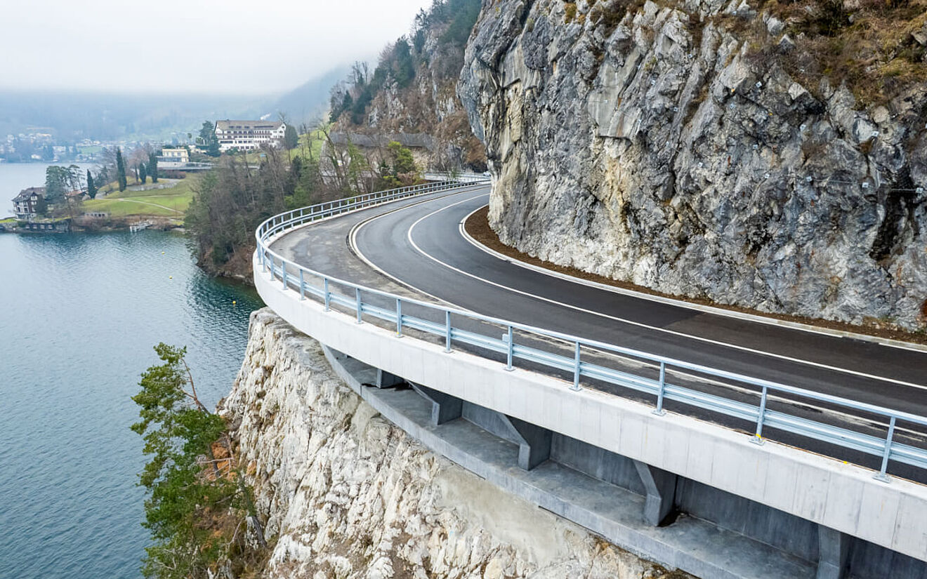
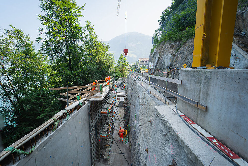
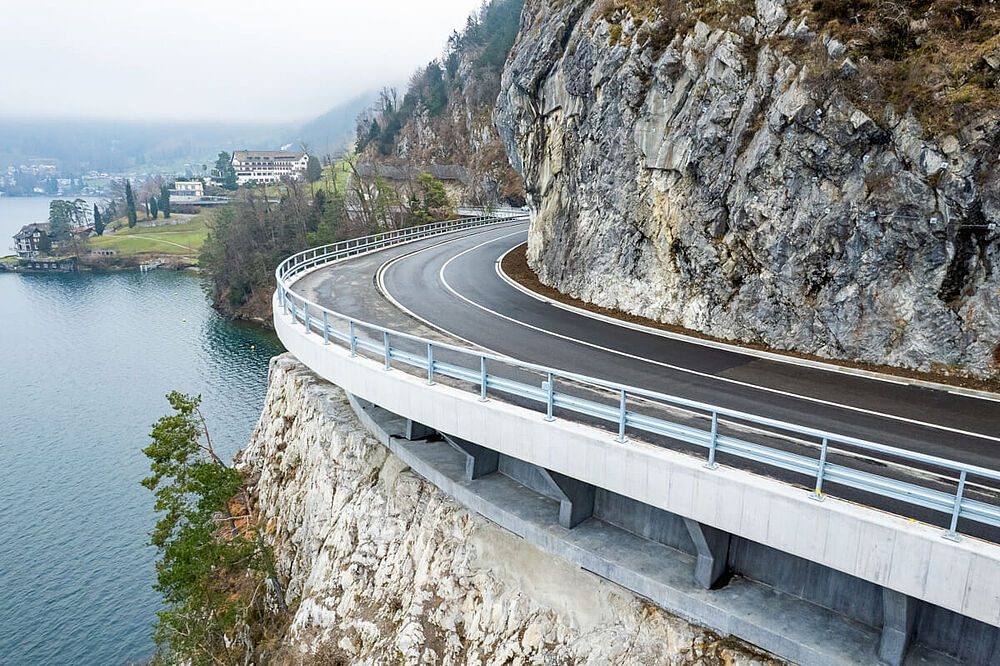
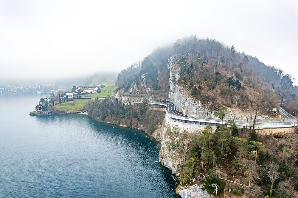
On the eastern shore of Lake Lucerne, between the municipalities of Weggis and Vitznau, a 400-meter section of cantonal road K2b is being rebuilt. The original alignment dates from 1885, was widened modestly in 1939, and now carries far more traffic than its builders ever anticipated. The replacement is a 224-meter-long supporting structure that winds along the cliff face in an elegantly curved form, set directly above the water of the lake itself.
In summary: > The K2b road above Lake Lucerne, originally built in 1885, is being rebuilt as a 224-meter back-anchored cantilever. > Landscape and traffic constraints drove a complex structural solution with 55 unique ribs and a polygonized rear wall. > ALLPLAN Civil’s parametric modeling handled the geometry through Cross-Section Extrusion and Polygonized Modeling. > The 3D model coordinated dense intersecting anchors, micropiles, and a wartime military installation hidden in the rock. > Parametric modeling made this infrastructure retrofit on a constrained site deliverable without complex geometry becoming a bottleneck. |
The K2b project is a striking piece of civil engineering. It is also a clear example of where parametric modeling earns its place. With landscape preservation, traffic continuity, and a constrained cliffside site all shaping the brief, the engineering team at Bänziger Partner AG arrived at a structural concept that resolves the constraints elegantly, but at the cost of geometric complexity that would have been very difficult to deliver using conventional 2D methods. This is where ALLPLAN Civil’s parametric modeling workflow made the difference.
 Copyright: Bänziger Partner AG, Zurich
 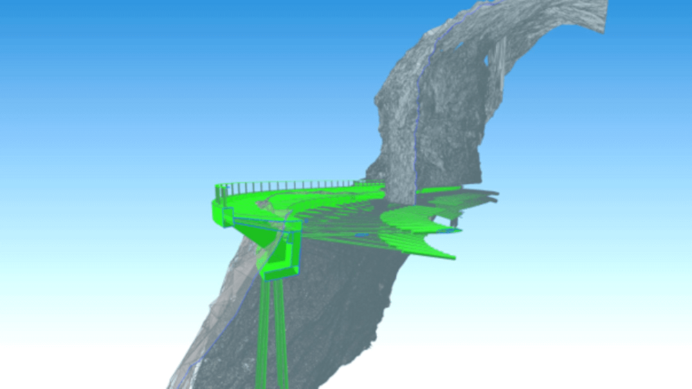 Copyright: Bänziger Partner AG, Zurich
  Copyright: Bänziger Partner AG, Zurich
 A structure shaped by its constraints
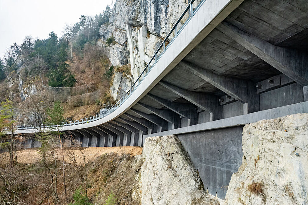
The K2b project combines two load-bearing concepts along its 224-meter length. Across the steepest section above the lake, the structure is a back-anchored cantilever with ribs. On the gentler flanks, angled retaining walls take over. The cantilever itself consists of a cantilever slab up to 60cm thick carried on cross plates spaced at 4-meter intervals, connecting to a rear wall and a strip foundation to form an integral structure. It is primarily anchored into the rock with prestressed anchors.
What makes the geometry demanding is everything that results from those choices. Across the 224 meters, 55 transverse ribs sit beneath the roadway slab in a grid running roughly perpendicular to the building axis, and none of them are identical. The downhill side of each rib follows the edge of the road, while the uphill side ends at the rear wall, which itself follows a freely defined line. The rear wall is then polygonized rather than truly curved, with an 8-meter grid on the wall and a 2-meter grid on the console heads. The result is a structure in which every rib has different dimensions and each one needs to remain coordinated with its segment of the polygonized rear wall.
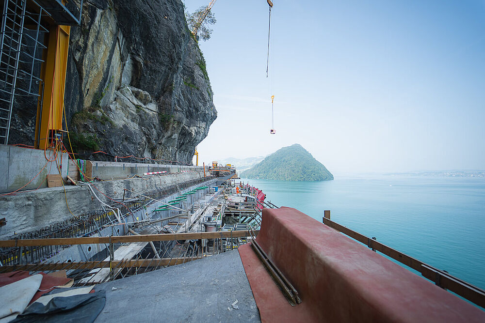 Copyright: Infinity Films
 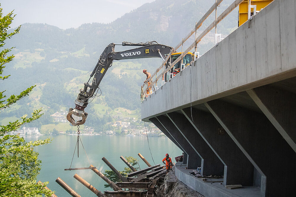 Copyright: Infinity Films
  Copyright: Infinity Films
 The value of parametric modeling
Modeling a structure like this in a conventional CAD environment would mean drawing each of the 55 ribs individually, then redrawing them every time the rear wall geometry shifted. On a project where the alignment, the rock surface, and the anchor positions all influence each other, that kind of manual reworking quickly becomes unmanageable.
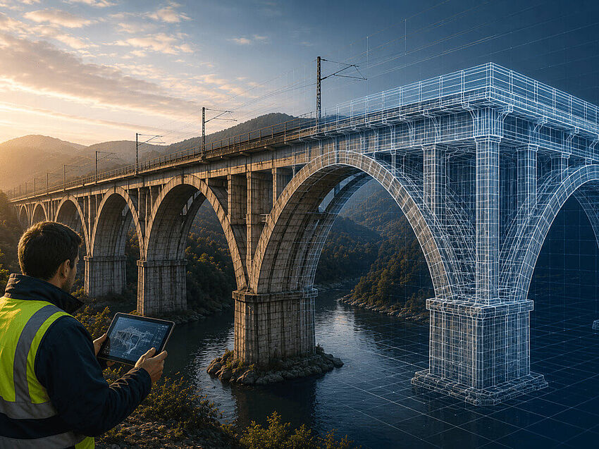
ALLPLAN Civil’s parametric modeling workflow was incredibly beneficial for this project. The cantilever’s deck and ribs were defined by cross-sections extruded along the road axis, using the Cross-Section Extrusion technique that ALLPLAN Civil uses for linear structures aligned with a true axis. The rear wall and console head polygonization were developed from the same parametric model using Polygonized Modeling, the technique designed for structures where geometry needs to follow a defined line without true curvature. Both techniques can be mixed within a single project, which is exactly what K2b required.
The advantage is that the geometry stays connected. When a parameter changes – such as a cross-section dimension, a grid spacing, or a length along the axis – the model updates accordingly, rather than forcing the team to rebuild manually. For the Lake Lucerne project, this allowed very precise and efficient processing of a structure that, only a few years ago, would have been substantially harder to deliver.
Coordinating a dense, intersecting site
The geometry of the structure is only part of the story. The rock above and behind the road has to accommodate a dense network of intersecting elements: temporary excavation anchors for the construction phase, permanent prestressed anchors carrying the cantilever, unstressed rock support anchors, micropiles, micropiles for the crane foundations, and anchors for the working scaffolding. There is also a military bunker within the rock that could not be drilled into.
For a site like this, the 3D model became a coordination tool as much as a design tool. The full project was modeled in ALLPLAN Civil: the terrain with the rock surfaces, the structure itself, the special civil engineering work, the auxiliary construction measures, and the bunker facility. This was the only way to ensure planning reliability and to identify spatial conflicts at an early stage, well before they could become problems on site.
The model also supported collaboration across the project team. The contractor consortium requested the work platform and crane concept as a 3D model at tender stage, allowing them to check for conflicts with the planned construction measures before work began. IFC models were exchanged through a shared planning platform, and the construction team used the model to carry out its work, particularly the rock removal. Meaningful visualizations could also be generated directly from the model for communication with the client.
 Copyright: Markus Frietsch
  Copyright: Markus Frietsch
  Copyright: Markus Frietsch
 A workflow built for complexity
Across Europe, ageing infrastructure on constrained sites is reaching the point where widening, retrofitting, or full replacement becomes unavoidable. Projects like the cantonal road K2b – where landscape, geology, and traffic continuity all shape the brief – generate bespoke, non-repeating geometry that conventional CAD methods struggle to deliver efficiently.
ALLPLAN Civil’s parametric workflows are built for exactly this type of work. By combining techniques like Cross-Section Extrusion and Polygonized Modeling with full 3D coordination and openBIM-based collaboration, the software allows engineering teams to take on geometrically demanding projects without the modeling itself becoming a challenge.
If you are working on a similar infrastructure project, you can explore ALLPLAN Civil with a free, 14-day trial and see how parametric modeling fits into your own workflow.